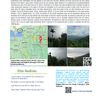
Jampui is located in the princely state of Tripura which is one of the seven sisters of North East India. Jampui Hills is a popular hill station in Tripura's North Tripura district. It is about 200 kilometers from Agartala and is the state's highest hill range. The hill range's average elevation is about 3,000 feet above sea level, which gives the hills their distinct weather and gives rise to the name Jampui, which means "Eternal Hills of Spring."
The panoramic views from Jampui Hills encompass the Chittagong Hills, the Kanchanpur-Dasda Valley, and the hill ranges of Tripura and Mizoram. Buses connect Jampui Hills to the major cities of North East India. The nearest rail station is Kumarghat/Pencharthal Railway Station, which is approximately 90 kilometers from Vangmun in the Jampui Hills.
What is the problem with this area?
Please see my post on Jampui's Problems, which describes in detail the problems that locals face:
Its recent popularity has infused multiple new homestays and food joints. This hill station had only one hotel earlier but in the last 3 to 4 years the number of homestays has mushroomed all over this place. But that is not the problem about which I am writing this article. The problem is as the population, both permanent and transient, is increasing rapidly the place is facing a huge scarcity of water.
Due to the geophysical nature of the hill station, no water can be stored naturally. After precipitation, 90% of the water flows out of the catchment towards Bangladesh and Mizoram. As a result, the people staying at the hill station lack the minimum requirement of water available. These people generally utilize rainwater harvesting tanks to store water. During the monsoon season, water is stored in the tanks for utilization in the non-monsoon season. But now due to the increasing demand from the tourist and also due to the change in climate in the area, the amount of water that can be stored is less compared to that before the last ten years.
So a study was carried out in Jampui for the vulnerability analysis of the hill station from the rising tourism and climate change. The main aim of the study was to first calculate the amount of water required to satisfy the standard amount of per capita water demand of the local inhabitants.
Next, the amount of water available from rainfall was calculated to find the exact quantity of water available for rainwater harvesting. Now, this quantity was determined for the last ten years and also for the next ten years. The comparison of both calculations depicted the water availability of the area per capita per year. To quantify the vulnerability an index was developed that considers the most significant parameters which rep[resents the vulnerability of any area.
While determining the significance we have considered the rapidly rising population and climatic abnormalities and their impact as the two criteria and the representative factors were selected as given below:....click here to read the complete article.
